

There is an abundance of stunning hikes on the South Island of New Zealand. The landscaper offers vistas of mountains, alpine trails, to lakes, and forests full of birdsong.
As an avid hiker, I have taken multiple hikes across New Zealand. Having moved from Wellington to Christchurch as a digital nomad, I was able to explore various tracks that offer breathtaking sceneries and a challenge to boot. Here are my top 5 handpicked favorite hikes on the South Island of New Zealand. If you’re up for an adventure like me, I hope you will enjoy these hikes too!
1. Lake Marian Track
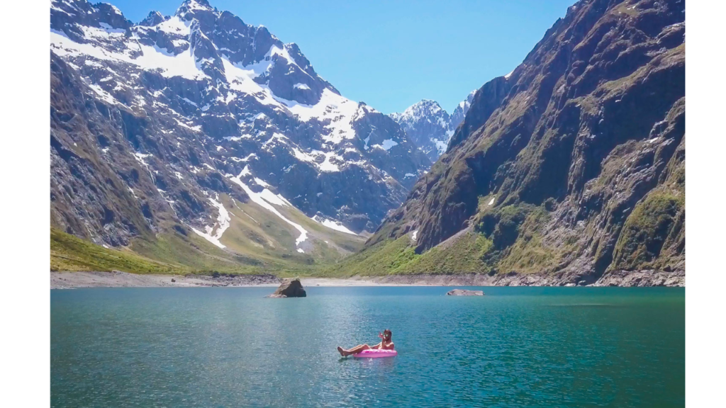
Source: Back Country Cow | Website
Lake Marian is in the deep south of the Fiordland National Park. This is a remote but pristine part of the country. Trust me, words and pictures do not do justice to its beauty.
This hike can be challenging with the elevation gain but it is relatively short. The path is marked the entire way. The trail ascends through beech forests. Which are the largest remaining indigenous forests in New Zealand. This type of terrain offers a glimpse of what the country was like before humans walked the land.
I recommend taking a moment to appreciate the vibrant but invisible life on this hike. Beech trees have a mutually beneficial relationship with a group of fungi, known as mycorrhizae. These fungi take sugars from the trees and return minerals from the surrounding soil. All this beneath your walking feet.
After about an hour and a half on the trail, the forest gives way to Lake Marian and the backdrop of mountains. If you are feeling brave, I invite you to swim in the cool waters of the alpine lake.
There is the option to spend the night camping on the shores of the lake. It is rocky but there are suitable spots to pitch a tent. Camp close the south shore of lake, away from any avalanche risk.
If the weather is calm and clear, the lake offers an immaculate reflection of the sky. The memory of it makes me wish I was back there now.
Take note: Prepare for all weather. Fiordland rains a lot. There is a toilet in the car park and just before the lake itself. Toilet paper is not guaranteed, so make sure to bring your own.
Total Distance: 3.1km one-way
Length: 3.5hours
Elevation Gain: 420metres
Level of Difficulty: Advanced
Nearest town: Te Anau
Location: The track begins from the Lake Marian car park. Head down Milford Road (SH94) from The Divide for a few minutes before heading 1 km down unsealed Hollyford Road.

2. Routeburn Track
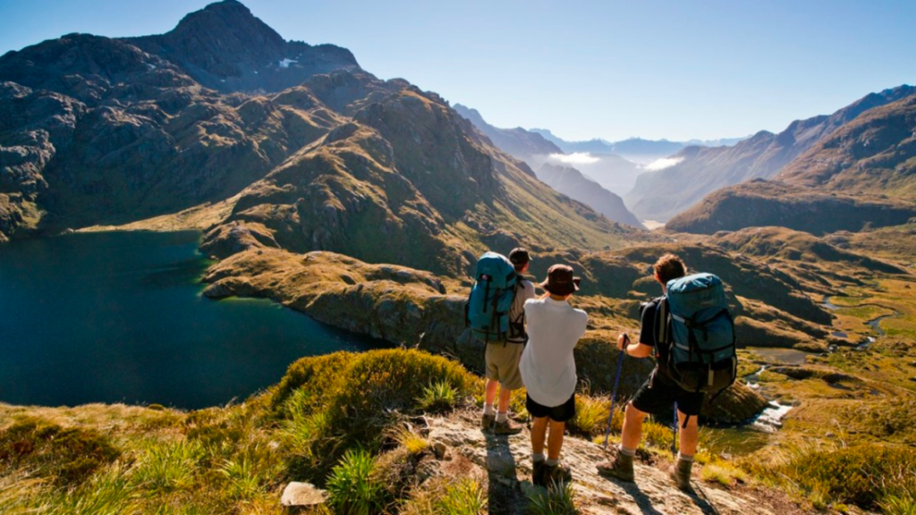
Source: Fiordland | Website
The Routeburn Track is one of New Zealand’s Great Walks. There are ten Great Walks, seven are on the South Island. Great Walks have well-maintained paths and easy-to-follow signs. It’s worth noting the Routeburn has a recommended hiking season, November to April. It can be dangerous outside of these months.
The Routeburn tracks link the Mount Aspiring National Park with Fiordland National Park. This track has mountain peaks, valleys shaped by ancient glaciers, towering cliffs, waterfalls and emerald-green lakes. The landscape offers great variety.
Parts of the track can be walked as a day hike, just pick your own place to turn around. Or it can be walked as a multi-day hike across 3 days and two nights.
This is not a loop track and can be walked in either direction. One track ends at the Routeburn Shelter (near Glenorchy) and the other at The Divide (closer to Te Anau).
There is abundant birdlife in forested sections of this track. Keep an eye out for tomtits, robins, fantails, wood pigeons, and bellbirds. You may also spot the endangered kea, which is the world’s only alpine parrot.
There are four public huts and two campsites on the Routeburn Track. These are looked after by the Department of Conservation (DOC). The Great Walks can be booked out pretty far in advance. But if you miss out on a hut booking, you can still hike. You will just have to camp. This option does involve carrying a tent and cooking equipment.
Total Distance: 32 km
Length: 3 Days, 2 nights
Elevation Gain: 800metres
Nearest town: Queenstown
Level of Difficulty: Intermediate.
Location: You can access The Routeburn Track either from the Routeburn Shelter (near Glenorchy). Or from the other end at The Divide Shelter (on Milford Road)
3. Hooker Valley Track
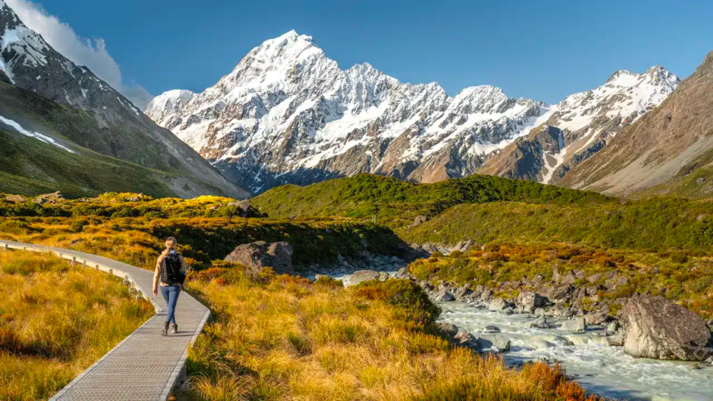
Source: Digital Travel Couple | Website
This is one of the most popular walks in Mt Cook National Park. Mount Cook National Park is a land of ice and rock. Wherein, the track passes through Hooker Valley and walks beside the Hooker River. The trail ends at a glacier lake, with views of Mount Cook.
If you are an early riser, the track at dawn offers a view of the first sunlight over the Southern Alps. I highly recommend sacrificing a bit of sleep for this golden sky offering.
There are three swing bridges along the way. The first bridge looks out to Mueller Lake. The second has a backdrop of mountains and the third is just before Hooker Laker.
There is a well-maintained boardwalk across the valley floor, this is where you walk above alpine meadows and get a good glimpse of Mount Cook.
Be prepared for all conditions. Weather can change quickly in alpine environments.
Total Distance: 10 km return
Length: 3 hours return
Elevation Gain: 124metres
Nearest town: Mount Cook village
Level of difficulty: Easy
Location: The Hooker Valley Track starts at the White Horse Hill Campsite and car park at the end of Hooker Valley Road.
4. Mount Robert Circuit
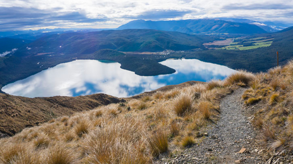
Source: See the South Island | Website
Mount Robert is in the Nelson Lakes National Park. This loop track is around the northern face of Mount Robert and offers views over Lake Rotoiti. It can be done as a day hike or overnight walk. The path is in great condition.
Before starting the hike, I recommended the pier at Lake Rotoiti. Beneath the wooden planks and hiding in the shadows are many, many eels. These slithering creatures are amazing to see. They also enjoy being fed with a bit of raw mince on a popsicle stick.
The Mount Robert circuit track can be steep in places but the rewards are well worth it. The views of of Lake Rotoiti and the St Arnaud Range are amazing.
Two tracks form the Mount Robert Circuit, Pinchgut Track and Paddy’s Track. You can walk the circuit in either direction. I recommend walking up Pinchgut Track and down Paddy’s Track.
The trail starts with an immediate uphill and it remains that way to the top. There are stretches of forest full of birdsong. At the top, there is Bushline Hut. It’s a great place to spend the night and hike out in the morning.
There is plenty of birdlife but be wary of Wekas. They are cute but will try to steal your stuff. Once, when I was wild camping, I woke up with my hiking shoes scattered in a nearby clearing. As a general rule for National Parks in New Zealand, you can wild camp anywhere that isn’t a hut or official campground. Some regions have more specific rules though, it’s worth checking before setting out.
Distance: 9km loop
Duration: 5 hours return
Elevation Gain: 600m
Difficulty: Advanced
Nearest Town: St Arnaud
Location: From St Arnaud, follow SH 63 west for 2 km, then turn into Mount Robert Road. Follow this for 4.9 km to the car park at the end. Pinchgut Track starts from the car park.
5. Bealey Spur Track
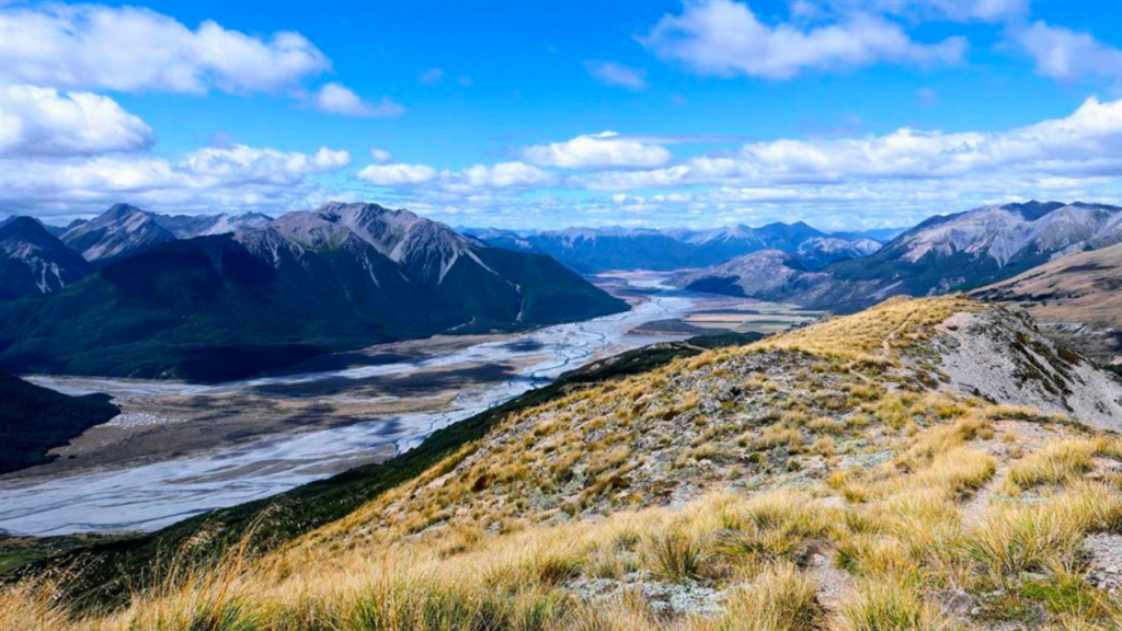
Source: Department of Conservation | Website
The Bealey Spur track offers views of the valley, Waimakariri River, and nearby mountains. The track lies mainly beneath the beech tree line. This is a relatively gentle hike, especially compared with the nearby Avalanche Peak Track.
Further uphill, the track soothes into grasslands, tussock, and subalpine scrub. Then turns into a boardwalk over marshland with mountains in the distance.
There is a hut aptly named Bealey Spur Hut. Well, it’s more of a makeshift shack with a crooked chimney and walls of mismatched corrugated iron. It does have 6 bunk beds and a small wooden table but I wouldn’t recommend spending the night here. I do highly recommend this hike though.
The track is well marked but there are points where it tapers dangerously close to cliff edges. Walk with caution in these sections.
Distance: 6km
Duration: 2.5hours one way
Elevation Gain: 550m
Nearest town: Arthur’s Pass village
Difficulty: easy
Location: The track starts from the car park off SH73, just past the Bealey Hotel, 14 km south of Arthur’s Pass village.
Hiking in New Zealand’s South Island
As we wrap up our exploration of the South Island’s top hikes, it’s evident that each trail offers its unique adventure, weaving through the very fabric of New Zealand’s stunning natural landscapes.
From the remote serenity of Lake Marian to the historic pathways of the Routeburn Track, the vibrant early mornings on the Hooker Valley Track, the challenging ascents of Mount Robert, and the tranquil beauty of Bealey Spur, these hikes are a testament to the diverse beauty awaiting the adventurous traveler.
For those yearning to explore, challenge themselves, and witness the unparalleled beauty of the South Island, these trails offer more than just hikes; they offer a gateway to experiencing the essence of adventure. So, pack your gear, embrace the unpredictable weather, and let me know what are your favourite hikes as you explore New Zealand!

This article is written by our writer, Harley Bell.
Harley Bell a New Zealander currently based in Christchurch. He is a writer, poet, and a digital nomad. He has a background in art and business, and was a business owner of a small cafe in New Zealand. He is interested in the intersection of nature and mythology. He has been published in various journals and draws his inspiration from vast amounts of coffee.